
Live updates: Flood risk remains for parts of Texas after days of rain
As the dayslong rash of rain eases in the Texas Hill Country, forecasters are now watching a network of major rivers in the region that will rush south over the weekend.
In the coming days, water levels are expected to rise at southern parts of the Nueces River and the Frio River, reaching major flood stages, according to National Weather Service forecasts.
Gov. Greg Abbott on Friday warned residents to remain on high alert, as very little rainfall could quickly become dangerous.
“The worst of the rain is behind us,” Abbott said. “But … very importantly … for a while, as in for days, the rivers are going to continue to rise because of the flow of water downstream. Residents and leaders need to understand the rivers will still rise and still pose life-threatening danger to anybody near those rivers.”
According to weather forecasts, the Frio River will likely crest when it reaches Derby, about 59 miles south of Uvalde. The Nueces River could crest for a longer period of time, forecasters said, as it accumulated more water from the heavy rainfall earlier in the week.
The rain that battered northern Uvalde, western Kerr and Edward counties has let up. Minimal rain is expected to fall in the central Texas region this weekend and residents will likely instead see high heat indexes, forecasters said.
“We’ve got a pretty good handle on how those rivers are going to be behaving over the next few days,” said Harrison Tran, a forecaster with the National Weather Service’s San Antonio and Austin office. “Sometimes the rate of rise can be quick, but it’s not a flash flood in the sense that it’s not immediate. The heavy rain falls, and then within a few hours, the rivers and streams respond. This is more of a gradual rise over the course of several hours or days.”
— Carlos Nogueras Ramos and Sneha Dey
Here’s what you need to know
- State officials warn rivers could still rise
- A look at where rain fell and rivers rose this week
- Crystal City orders evacuations
- Cleanup efforts underway in Uvalde
- Uvalde was among the hardest hit by storms, floods
- Drifting anti-immigrant buoys briefly close 2 Rio Grande bridges
- Laredo told to prepare for moderate flooding
- Flood risk remains for parts of Texas after days of rain
- Hill Country residents face renewed anxiety amid new flooding
- Governor confirms second flood-related death
- Kerr County flood victim identified
- Hill Country preparing for another night of floods, swelling rivers
- Sid Miller declares agricultural emergency amid drowned livestock, flooded crops
- Community Foundation of the Texas Hill Country steps in
- Rain to ease in the afternoon but more could be coming
- Camp CAMP says all are safe
- Kendall County rescues two, shelters nearly 70
- Dam floodgates to open along Highland Lakes system
- One person has died in the flooding, Gov. Abbott says
- More than 40 rescued as rain pummels Uvalde
- Flash flood emergency declared for Pedernales River
- Life-threatening flooding in 14 counties, weather service says
- Additional rain expected to batter Kerr and Uvalde counties after a long night of showers
- Life-threatening floodwaters endanger southwest Texas
- Dangerous flood wave moving down Guadalupe River near Center Point
State officials warn rivers could still rise
Even as the rain lets up, officials on Friday said they still expect floodwaters moving downstream to cause rivers to rise and threaten surrounding communities.
“We want everyone just for the next 24 to 48 hours to be fully aware of the danger that water can provide to your life right now,” Gov. Greg Abbott said at a press conference in Uvalde on Friday.
The Nueces River, which snakes around Uvalde, is currently one of the greatest threats, Abbott said. The state has already deployed thousands of first responders and vehicles, as well as boats and aircraft, leading to rescues of about 270 people. Local officials in the Uvalde and Zavala regions have rescued an additional 300 people in the area.
“It’s still a very dynamic situation where we had days of 10 or 15 inches of rain. Another day of one or two inches of rain could produce equally catastrophic impacts,“ W. Nim Kidd, the chief of the Texas Division of Emergency Management, said. “So we are not out of this fight yet.”
Abbott also declared a major disaster declaration on Friday, opening the door to federal aid to help rebuild after the floods. The disaster declaration will include at least 28 counties hit hardest by the floods.
— Sneha Dey
A look at where rain fell and rivers rose this week
The National Weather Service issued a report listing rainfall observations from the hardest-hit counties as of Friday. Four locations in Uvalde and Kerr counties measured more than 2 feet of rain between Monday and Friday.
That heavy rainfall caused major flooding along multiple rivers Thursday. Those water levels had receded by Friday afternoon, but flood warnings remained in effect as water continued downstream.
— Dan Keemahill
Crystal City orders evacuations
Residents in the Mexico Chico neighborhood of Crystal City, a community to the south of town, have been ordered to evacuate their homes. The neighborhood, which is south of town, sits near the Espantosa River Slough.
Local officials said in an announcement around noon that U.S. Border Patrol agents, the police, and volunteer fire department personnel would go door-to-door to help residents evacuate.
Crystal City is 40 miles south of Uvalde.
— Carlos Nogueras Ramos
Cleanup efforts underway in Uvalde
Signs of chaos from flooding could be seen on nearly every street in some form across the city of Uvalde on Friday as cleanup is underway by officials and residents returning home.
Water lines marking the flood’s peak reached 3 feet in some Uvalde homes as potted plants, yard decorations and detritus was flung throughout neighborhoods.
Debris has already been pushed aside on highly traveled roadways, but several roads in residential neighborhoods were still closed in the early afternoon. Alerts went out to residents in the afternoon warning that FM 2369 had been closed due to pavement damage.
Water was still overflowing from the Leona River into Uvalde Memorial Park where workers cleared debris behind Uvalde’s civic center. Gov. Greg Abbott is expected to deliver an update on statewide recovery efforts at the center later this afternoon.
— Ayden Runnels
Uvalde was among the hardest hit by storms, floods
Uvalde, among the hardest hit by the storms and floods that swept the Texas Hill Country, continues to grapple with the aftermath of a dayslong stretch of heavy rainfall, even as rain subsided through the night and early morning Friday.
Up to 28 inches of rain lashed parts of the county over the last five days, forecasts indicate, and much of it filled rivers and creeks as the soil became oversaturated, worsening road conditions and diminishing prospects of immediate relief. Most of that rain fell in Uvalde County’s northern portion.
On social media, images showed flooded or damaged roads and a collapsed bridge.
Just this morning, the Texas Department of Transportation said the U.S. 90 corridor had reopened after closing earlier this week due to deteriorating weather conditions.
Texas game wardens had conducted 147 rescues and 83 evacuations across eight counties as of 3 p.m. Thursday, with a video showing the team using a helicopter to rescue a family in Uvalde from a flooded house.
Gov. Greg Abbott is expected to hold a news conference in Uvalde at 3 p.m.
— Katlyn Ma and Carlos Nogueras Ramos
Drifting anti-immigrant buoys briefly close 2 Rio Grande bridges
About 100 buoys that the federal government planned to install as anti-immigration deterrents near Eagle Pass drifted into the Rio Grande, prompting officials to close two key bridges along the U.S.-Mexico border for about three hours, reopening them just after midnight Friday.
Eagle Pass shut down transit at the bridges while it worked to determine whether the buoys posed a threat, City Manager Homero Balderas said. About 9,000 vehicles cross both bridges daily, transiting between Eagle Pass and Las Piedras.
— Carlos Nogueras Ramos and Katlyn Ma
Laredo told to prepare for moderate flooding
National forecasters warned Laredo residents to expect the Rio Grande river to enter flood stage Saturday night, with highest levels of nearly 21 feet expected by Sunday evening. River levels are typically under 5 feet.
A moderate flood warning has been issued for Webb County, meaning water can be several feet deep in low-lying areas, said Kirsten Snodgrass, a meteorologist with the National Weather Service. Laredo is “susceptible to flash flooding,” and officials are now meeting with the weather service to assess the current forecast for next steps, she said.
The Amistad and Falcon reservoirs – upstream and downstream of Laredo on the Rio Grande – are not included in the warning.
— Katlyn Ma
Flood risk remains for parts of Texas after days of rain
Parts of southwest Texas and the Hill Country endured a third night in a row of heavy rain and flash flooding that has left at least two people dead and forced evacuations.
The Hill Country, the Rio Grande Plains and the southern Edwards Plateau remain among the hardest-hit areas with “life-threatening flooding” and “locally catastrophic flash floodings of creeks, streams, and other low-lying locations”, according to the National Weather Service.
The agency forecasts rainfall totals of 2 to 4 inches for that region, with isolated areas potentially receiving up to 8 inches overnight and into Friday morning. Experts warn that the additional rainfall could worsen an already critical situation.
As of Thursday night, seven locations were experiencing major flooding or at significant risk: the Pedernales River at Johnson City; the Guadalupe River near Spring Branch; Cibolo Creek at Sutherland Springs; Cibolo Creek near Falls City; the Frio River below Dry Frio near Uvalde; the Nueces River at Laguna; and the Nueces River below Uvalde.
Water levels at all of these locations are expected to recede on Friday.
— Alejandro Santos Cid
Hill Country residents face renewed anxiety amid new flooding
For many Hill Country residents, Thursday’s flooding brought back the familiar levels of wreckage and trauma that they suffered through during the July 2025 floods that killed 119 people in Kerr County.
In many parts of the county and elsewhere, scenes were strikingly similar: fences lined with debris and personal effects, cars strewn in all directions and water lines that hugged the bottoms of homes. The response by Hill Country community members echoed last year, too, as neighbors coalesced in one another’s homes to help begin cleanup and shelters welcomed those displaced with hot meals and clean clothes.
Rain in the early morning Thursday pushed the Guadalupe River in Comfort to as much as 37 feet and the Pedernales River to 34 feet in Fredericksburg, according to river gauges. Near Kerrville last year, the Guadalupe River in Hunt spiked to a record-breaking 37.5 feet on July 4.
Those who have lived along the rivers have been accustomed to flooding for decades, but the sudden overflow last year caught even longtime residents off-guard. Since then, residents sought solace in the idea that the river’s sudden swelling had been a once-in-a-century event — an apparent illusion shattered in the early hours Thursday.
“When it did it last year, we’re like, ‘Oh my God, it’s never happened before, ever, so maybe it won’t happen again in our lifetime,’” said Sherri Steadham, who lives in Center Point within eyesight of the river. “And here we are, a year and a few days later.”
Though the rate of flooding and the severity of human casualties have differed — two people have died, as of Thursday evening — watching the waters rise and taking calls from trapped residents reminded many first responders of the fear-stricken residents they saved from harrowing floodwaters last year.
“When that rain’s hitting really hard, and you hear it pounding, you can see the look on their faces,” said Razor Dobbs, a volunteer firefighter at Center Point Fire Department, who responded to last year’s flood. “You can see the look on their faces, this is it.
— Ayden Runnels and Ellie Ashby
Governor confirms second flood-related death
Gov. Greg Abbott confirmed Thursday at a press conference that two people died in the ongoing flooding across south-central Texas.
The victims are John Mark Steward, 65, of Kerrville, who was swept away in an RV near Comfort along the Guadalupe River, and a 74-year old man in Uvalde County who was swept away while driving across a flooded roadway.
Abbott warned that life-threatening, catastrophic flooding remains the biggest threat through tonight and into early Friday, with additional risks of tornadoes. Flood watches remain in effect for 59 counties.
The state has mobilized about 2,350 emergency responders, more than 1,400 vehicles and specialized equipment, 85 boats and 21 aircraft. Officials have completed over 230 rescues.
“Protecting life remains our top priority,” Abbott told reporters, emphasizing that response efforts — not recovery — are the focus as conditions continue to change rapidly.
Abbott said last year’s deadly flooding served as “a warning” that prompted a more aggressive response this year, including the early evacuation of more than 80 people from campgrounds before rivers began to rise. He said that first responders are applying the lessons learned from last year and being “very aggressive.”
He added that state leaders will review this flooding event after the emergency ends to determine whether additional emergency management or flood-related legislation is needed.
“We will take experiences gained from this flooding event and evaluate if further laws are needed, or the existing walls need to be recalibrated,” he said.
– Alejandra Martinez
Kerr County flood victim identified
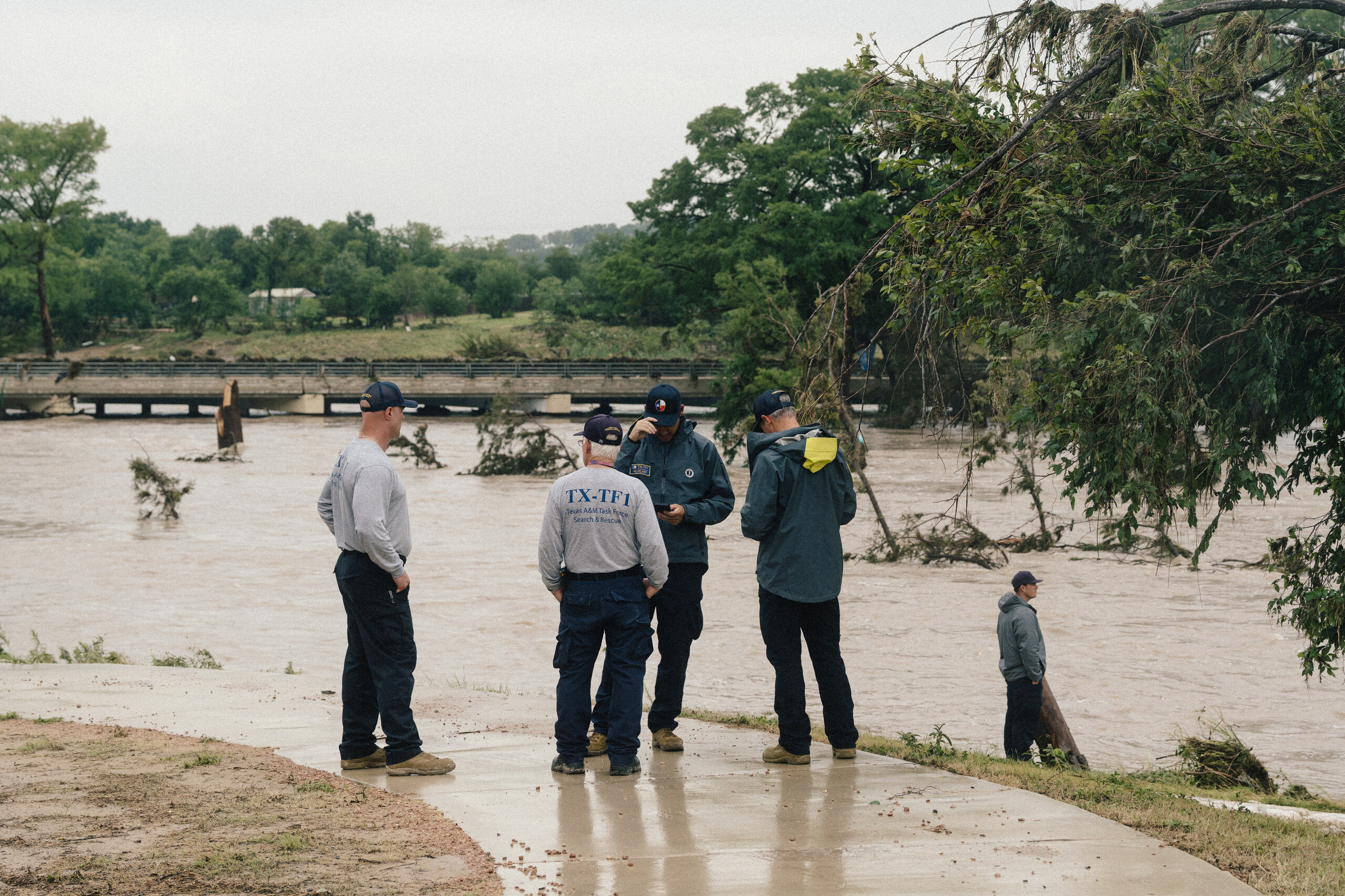
John Mark Steward, a 65-year-old Kerrville resident, was identified by his wife as the first victim of flash flooding that has swept through southwest Texas and the Hill Country this week.
“My heart is broken. I am devastated. My husband, Mark, was found and went to be with Jesus,” said his widow, Jennie Steward, in a statement on social media. “Mark, my love, I will forever be grateful for the beautiful years we shared together. You made me a better person. I love you all.”
The mobile home where Mark and Jennie lived on Junction Highway, Kerr County, which runs parallel with the Guadalupe River, was swept away and destroyed by the rising water on Thursday morning. Only John Mark Steward was inside the home at the time — his wife had traveled to Dallas.
At 3:06 a.m., Steward called a neighbor to tell him that his home was floating away, according to the Houston Chronicle. He phoned his neighbor a final time to say his home had been destroyed before the line went dead.
Steward was a caretaker at Sage Park Guadalupe, an assisted living facility for seniors, the Chronicle said. Before that, he worked as a pest control technician. Wednesday marked the couple’s third wedding anniversary.
Steward’s cousin, Maranda Freeman, shared her condolences in a Facebook post. “Our family is completely heartbroken by this loss,” Freeman said. “While we had been holding onto hope and praying for a miracle, we now find comfort in knowing that he has been found and is at peace in the arms of our Lord.”
— Alejandro Santos Cid
Hill Country preparing for another night of floods, swelling rivers
Parts of the Texas Hill Country are preparing for one more round of heavy rain tonight, National Weather Service forecasters said.
While showers and storms may briefly decrease early this evening, another round of thunderstorms is expected to redevelop overnight across portions of the Hill Country, southern Edwards Plateau, and the Rio Grande. Although the storms are not expected to be as widespread as in previous nights, the flood threat remains extremely high.
“There’s no more room to take rainfall,” forecaster Jason Runyen said at an afternoon webinar.
After days of relentless rain, saturated ground means any additional rainfall will immediately run off, worsening flash floods. Areas west of Interstate 35 and north of the U.S. 90 corridor are especially vulnerable.
Several rivers remained at dangerous levels as “catastrophic flash floods” continued Thursday afternoon. The Nueces River below Uvalde is expected to crest at a record high above 27 feet tonight into Friday, creating downstream concerns for Crystal City. The Pedernales River, which has already experienced devastating flooding, crested near 34 feet upstream and is now sending a major flood wave toward Johnson City, where rapid rises are expected in the evening before water levels slowly begin to recede.
Forecasters expect rainfall to decrease beginning Friday night and through the weekend.
— Alejandra Martinez
Sid Miller declares agricultural emergency amid drowned livestock, flooded crops
Texas Agriculture Commissioner Sid Miller declared an agricultural emergency in response to the torrential flooding in the state. This comes after reports of drowned livestock and flooded crops in some areas.
Miller’s declaration allows the Texas Department of Agriculture to use relief resources to help farmers, ranchers and other businesses related to agriculture as they recover from widespread flood damage.
In a statement, Miller said Texas agriculture is taking another blow.
“Families who make their living on the land are watching their crops, livestock, and homes threatened by rising floodwaters,” Miller said.
There are reports of hundreds of livestock trapped and potentially drowned along the Pedernales River and Cibolo Creek near Falls City. Similar reports have come out of the Frio and Nueces Rivers near Uvalde.
Miller also encouraged people to help recovery efforts by donating to the department’s relief fund.
— Jayme Lozano Carver
“We knew that there would be a role for philanthropy”
A little more than one year after mobilizing to raise and distribute millions of dollars for response and recovery from the devastating July 4 flood in Kerr County, the Community Foundation of the Texas Hill Country launched a new flood relief fund Thursday.
The fund will support communities in the 10-county region that the foundation supports, which includes hard-hit Uvalde, Gillespie and Kendall Counties in addition to Kerr.
Some in the area woke to relentless rain Thursday morning, and the foundation leader realized a similar flooding scenario was unfolding, foundation Chief Executive Officer Austin Dickson said. Organization leaders felt prepared to take action to help.
“There is a significant number of evacuations, water in homes and businesses, roads and bridges washed out, many physically damaged,” Dickson said. “It was at that point that we knew that there would be a role for philanthropy and long-term recovery.”
In San Antonio, San Antonio Animal Care Services put out a call for people to help temporarily foster dogs as a surge of animals arrived because of the weather. Volunteers were directed to 4710 State Highway 151 to meet dogs that needed immediate homes.
— Emily Foxhall
Rain to ease in the afternoon but more could be coming
After hours of incessant rainfall, forecasters at the National Weather Service said hard-hit parts of Texas can expect some relief Thursday afternoon but warned that the storms could return in the evening.
Forecasters are monitoring northern Uvalde, Del Rio and Bandera counties, where since morning storm systems have formed over already drenched areas. Those storms migrated north to Kerr County, exacerbating flooding and spiking the Guadalupe River to dangerous levels.
Forecasters estimate it is raining at a rate of two inches an hour. That’s down from earlier reports of six inches of rain in some areas, but the soil is so saturated that the water is running off, resulting in flooding.
“The rainfall rates have come down, fortunately, from what they were earlier,” forecasters said.
— Carlos Nogueras Ramos
Camp CAMP says all are safe
Summer camps near Hunt were not flooded, Gov. Abbott said during a Thursday news conference, adding that his office is still getting updates on others and could not confirm any more details.
The Kerr County Sheriff’s Office said all camps in the county have been contacted and confirmed that their campers are safe.
The Children’s Association for Maximum Potential, a beloved program for individuals with disabilities known as Camp CAMP near the Guadalupe River, said Thursday that campers and staff would remain in the campgrounds, which stand 80 feet above the riverbank, and continue with programming. In a statement on social media, the camp said it is “fully prepared for changing conditions, with back up generators in place.”
“At this time, travel to the area is not safe,” the camp said in a statement on social media. “In accordance with our Emergency Action Plan, sheltering in place remains the safest course of action for everyone on site. … We also have ample food and essential supplies on hand to care for everyone at the camp for as long as needed.”
— Carlos Nogueras Ramos and Terri Langford
Kendall County rescues two, shelters nearly 70
Two people were rescued and 68 have sought shelter in Kendall County as the Guadalupe River swelled to life-threatening levels early Thursday morning, prompting multiple flash flood emergency warnings from forecasters, emergency management officials said in a news conference.
County officials said they’d been coordinating to deploy rescue efforts since 2 a.m. in advance of the early wave of rainfall.
“We didn’t know where the water was going to hit, how much, and if it was going to affect us,” county officials said.
— Carlos Nogueras Ramos
Dam floodgates to open along Highland Lakes system
Several Central Texas reservoirs have reached capacity, prompting operators to begin releasing water downstream along the Colorado River.
The Lower Colorado River Authority plans to open multiple floodgates at Alvin Wirtz Dam, which forms Lake LBJ west of Marble Falls, and Max Starcke Dam, which forms Lake Marble Falls. Both dams are part of the Highland Lakes system operated by LCRA.
Officials are urging anyone living, working or recreating downstream to take precautions as water levels rise and the river flows much faster than normal. Conditions can also change quickly, especially if additional rain falls.
While reservoir releases are common in Central Texas, they can create hazardous conditions. Reservoir operators control how much water is released to reduce flood risks downstream.
The LCRA warns that unscheduled water releases may occur at any time due to emergency hydroelectric generation or other operational needs.
— Alejandra Martinez
One person has died in the flooding, Gov. Abbott says
One person has died in the flooding and more than 70 others have been rescued, Gov. Greg Abbott said Thursday.
The death of the adult occurred between Kerrville and Comfort but Abbott had no other details.
“I am informed that the loss of life is not a camper,” Abbott said.
“We have been engaged in making rescues,” Abbott said. “We have rescued well over 70 people already and we will continue making those rescues every step of the way,” Abbott said.
After last year’s deadly flooding, state legislators required warning sirens to be installed in areas hit by the July 2025 disaster that regulators identified as having a history of severe flooding and other factors such as where people could die or structures could flood.
The Upper Guadalupe River Authority had so far installed six sirens in Kerr County expected to be paid for with state funding, but all of those sirens were upriver of where the worst river flooding occurred Thursday, according to river gauges.
Abbott confirmed Thursday that the sirens worked except for one that did not go off as soon as it was triggered.
“All the sirens worked,” he said. “With regard to one of the sirens and sometime before 4 a.m. this morning there was a triggering of the siren that did not go off immediately. But it was triggered again five minutes or two minutes later and it did go off at that time,” he said. “So for all practical purposes, the functionality of the sirens worked just fine and so those alarms went off.”
While a lot of attention is on the Kerrville and Uvalde areas, Abbott said he was concerned about the “massive challenges” in the Rio Grande Valley and other areas hit by heavy rains.
“People need to understand to expect very meaningful flooding in the Rio Grande,” he said.
So far, 1,300 personnel have been “actively engaged” in responding to the flooding, Abbott said.
Unlike the 2025 flooding, which was concentrated upstream from Kerrville near Hunt, this year’s flooding is happening downstream from the Guadalupe River headwaters, he said.
The Guadalupe River at Center Point spiked just below the July 2025 record, according to federal data. In Comfort, it spiked just above last year’s record, hitting 37.08 feet compared to last year’s 35.64 feet, a difference of 1.44 feet, according to the gauge.
More than 90 new River Sentry flood warning sirens that the directors of Camp Mystic raised money for have also been installed in Kerr County, again largely upriver of where the worst river flooding occurred Thursday, according to a company map. Twenty-seven campers and counselors died at Camp Mystic in last year’s floods, along with the camp’s co-owner and executive director. Some of these sirens were stationed in the Kerrville area.
— Terri Langford and Emily Foxhall
More than 40 rescued as rain pummels Uvalde
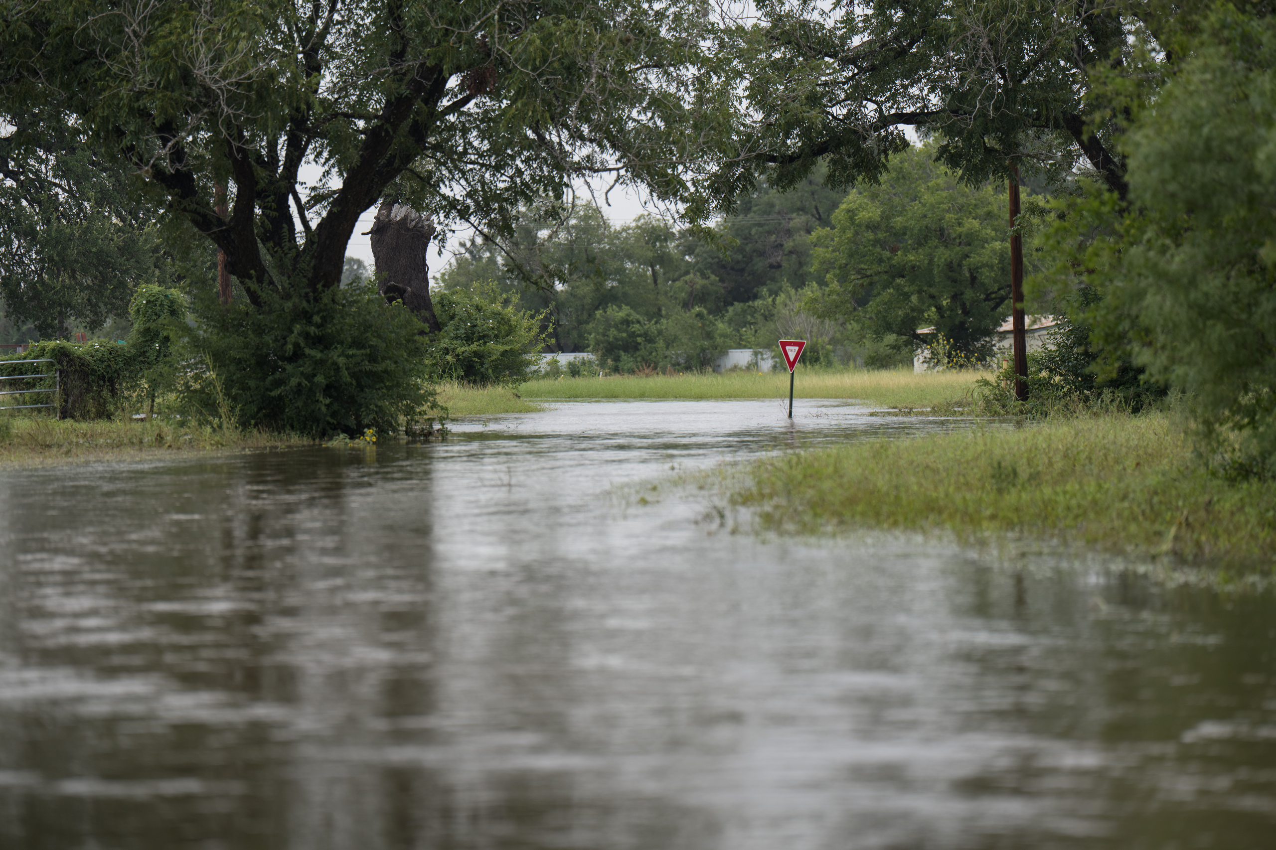
Intense overnight rain in Uvalde submerged roads and homes, prompting more than 40 rescues. After receiving 7 inches of rain overnight, Uvalde was placed under a flash flood emergency, with mandatory evacuations underway, as drone footage from the Weather Channel showed the Leona River overflowing near Uvalde.
The Uvalde County Office of Emergency Management closed all major highways and city streets, issuing a shelter in place order.
More than 40 people have been rescued, most of them in Uvalde County, according to the Texas Parks and Wildlife Department. Uvalde officials have deployed boats for rescue operations and plan to fly helicopters.
Roads across Uvalde County are also flooded, including Highway 90, where videos have shown pavement torn up by floodwaters.
— Katlyn Ma and Carlos Nogueras Ramos
Flash flood emergency declared for Pedernales River
Federal forecasters issued a flash flood emergency for the Pedernales River in Gillespie and Blanco Counties, warning of life-threatening flash flooding and catastrophic damage.
A “large and deadly flood wave” was pushing down the Pedernales River, the forecast alert said. At Fredericksburg, the river had already passed 28 feet at 8 a.m., according to a U.S. Geological Survey gauge. It was forecast to keep rising into a major flood.
Forecasters urged people to move to higher ground immediately.
Dangerous flood wave moving down Guadalupe River near Center Point
Center Point through Bergheim on the Guadalupe River were under a flash flood emergency early Thursday morning as forecasters warned of a “large and deadly flood wave” pushing down the Guadalupe River and urged people to seek higher ground.
“The river gauge at Center Point has risen 32 feet in 4 hours and is expected to reach a crest similar to July 4, 2025 catastrophic river flood,” the forecast warning said. “Flash flooding is already occurring.”
A flash flood emergency was also extended upstream in Hunt and Kerrville in Kerr County through 3 p.m. Thursday where up to a foot of rain had fallen and more was expected, according to the alert. Kerrville officials asked residents to shelter in place if safe to do so.
Forecasters warned the damage could be catastrophic. The river near Center Point hit nearly 38 feet at 5:20 a.m., according to a U.S. Geological Survey gauge. A steep rise was recorded downriver in Comfort, passing above 33 feet at 6:25 a.m. No rise had been recorded yet at the next gauge near Bergheim as of 6:45 a.m.
In Hunt and Kerrville, forecasters reported between three to six inches of rain had fallen in that area already as of 3 a.m. Thursday with a heavy rainfall rate of two to four inches of rain expected and the Guadalupe rising.
“Flash flooding is already occurring with evacuations, escalating water rescues, and water beginning to enter structures,” the alert said.
The gauge on the Guadalupe River at Hunt had spiked just above 20 feet around 3:35 a.m. Thursday morning, which was below what’s considered a major flood there, according to the USGS gauge. The river later hit nearly 17 feet in Kerrville, also below what’s considered a major flood.
Kerrville officials also asked residents to minimize water use as a preventive measure because of operational issues at its water plant.
More than 100 people died in Kerr County last summer during flash floods early on July 4, when more than 10 inches of rain in places on the river’s South Fork fell largely in the span of several hours, with much of the worst damage in Kerrville and upriver.
— Emily Foxhall
Life-threatening flooding in 14 counties, weather service says
All or portions of 14 counties were under flash flood warnings issued by the National Weather Service as of 7 a.m. Thursday morning as heavy rain had fallen across the area. A flash flood warning means life-threatening flooding is imminent or likely.
Uvalde and the Knippa area were under flash flood emergencies, meaning “historic and catastrophic” flash flooding was imminent or already happening that could damage entire communities. The area had received up to 8 inches of rain over two hours as of 4 a.m., according to the forecast alert, and had already been drenched with heavy rain over several days.

Structures had flooded and water rescues were occurring, according to the forecast alert.
Areas along the Guadalupe River between Center Point through Bergheim, as well as in Hunt and Kerrville, were also under flash flood emergencies.
Counties under flash flood warnings included:
- Sutton County
- Kendall County
- Kerr County
- Bandera County
- Gillespie County
- Real County
- Kinney County
- Maverick County
- Val Verde County
- Uvalde County
- Edwards County
- Zavala County
- Medina County
- Kimble County
According to the weather service, the following cities and areas will experience flash flooding: Kerrville, Comfort, Waring, Sisterdale, Center Point, Crown, Medina, Fredericksburg, Bandera, Kerrville-Schreiner Park, Tivydale, Camp Verde, Harper, Vanderpool, Hunt, Uvalde, Sabinal, Knippa, Kerr Wildlife Management Area, Lost Maples State Natural Area, Mountain Home, Rio Frio, Del Rio, Brackettville, Lake View, Amanda, Laughlin AFB, Val Verde Park, Standart, Cienegas Terrace, Long Point, Black Brush Point, Diablo East, Amistad Village, Governors Landing, Escondido Estates, 277 South Boat Ramp, 277 North Campground, Lake Ridge Ranch, San Pedro Canyon, Devils Shores, Rough Canyon Recreation Area, Leakey, Camp Wood, Barksdale, Vance, Tuff, Brackettville, Spofford, La Pryor, Dabney, Anacacho, Washer, Darling, Alamo Village, Turkey Mountain, Fort Clark Springs, Waltonia, Ingram, Boerne, Fair Oaks Ranch. Welfare, Walnut Grove, Nelson City, Kreutzberg, Bergheim, Kronkosky State Natural Area, Old Tunnel State Park, Kendalia, Bankersmith, Guadalupe River State Park, Bandera Falls, Spring Branch, Lakehills, Hondo, D`Hanis, Hill Country State Natural Area, Lake Medina Shores, Concan, Reagan Wells, Garner State Park, Laguna, Montell, Utopia, Cline, Blewett, Roosevelt, Telegraph, Cleo, I-10 near the Sutton-Kimble county line.
The warning includes the following streams: Block Creek, Sabinas Creek, Holliday Creek, Jacobs Creek, Verde, Creek, Turtle Creek, Cherry Creek, Guadalupe River, Wasp Creek, Bruins Creek, Joshua Creek, Steel Creek, Elm Creek, Werner Creek, West Sister Creek, Violet Creek, Cypress Creek and East Sister Creek, Pipe Creek.
— Emily Foxhall
Additional rain expected to batter Kerr and Uvalde counties after a long night of showers
Additional rainfall fell across Central Texas overnight, with storms battering several towns particularly vulnerable to the rising Guadalupe River, forecasters at the National Weather Service’s San Antonio office said.
Forecasters said they expect the heaviest downpours in Kerr and Uvalde counties after a long night of heavy rain. Over the last six hours, towns along central Kerr County, including Kerrville, Hunt and Ingram, saw as much as 8 to 10 and a half inches of rain. The storms also showered towns downstream from the Guadalupe River, in Center Point, Comfort and Bergheim, forecasters said.
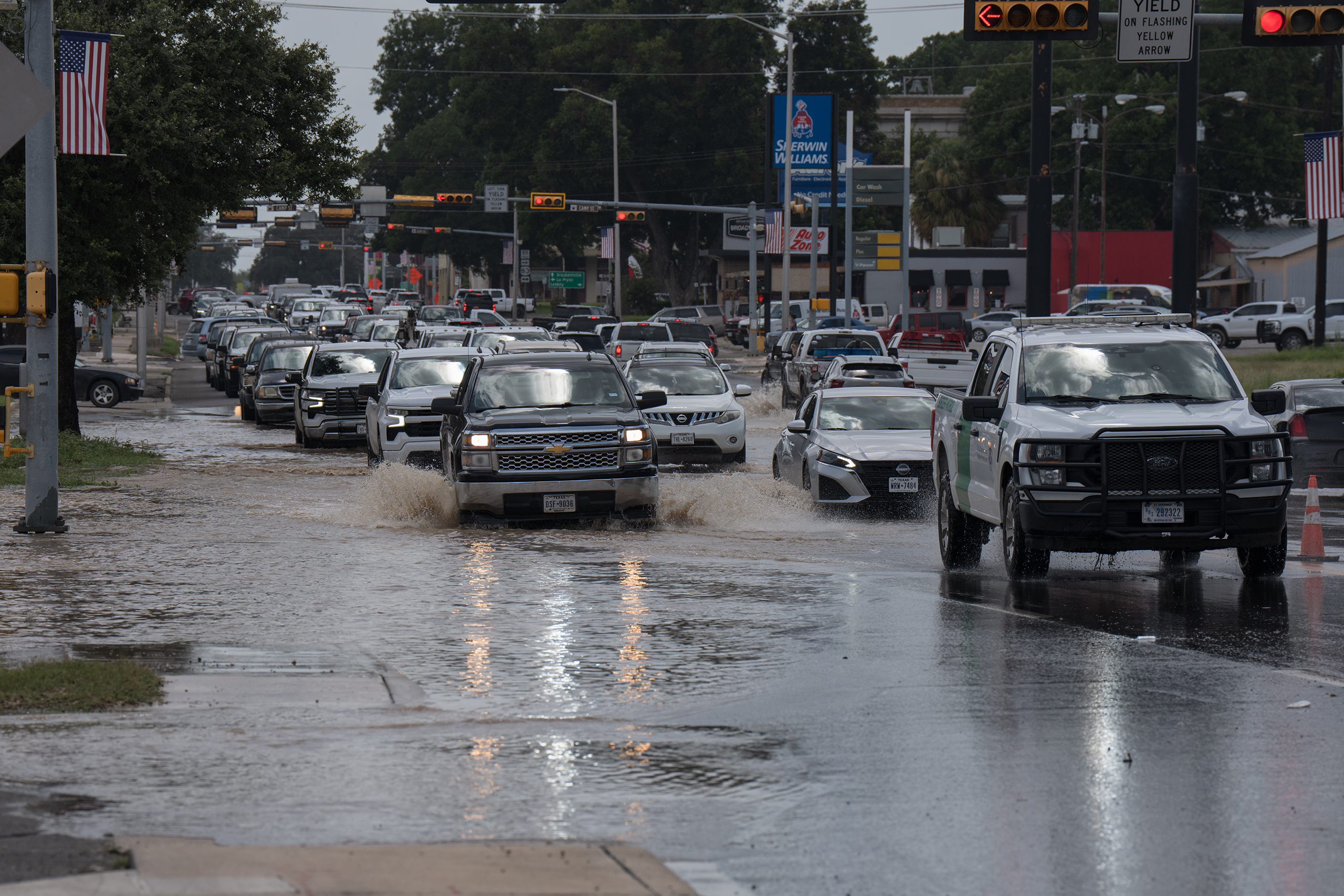
Nearly 20 inches of rain has fallen over the past 48 hours in central and northern Uvalde County, forecasters said.
Storm activity is developing further south in Bandera County and is likely to travel north, bring more rain in the coming hours.
“Showers and thunderstorms and the rainfall rates are picking up again a little bit acrossKerr County, and even back into those areas that got hit hard across Uvalde and back into the portions of the Hill Country,” said Eric Platt, a meteorologist with the National Weather Service. “So it’s not over just yet.”
— Carlos Nogueras Ramos
Life-threatening floodwaters endanger southwest Texas
National Weather Service forecasters were expecting stormwater to push rivers and creeks over their banks in southwest Texas — including the Nueces and Frio rivers — Wednesday afternoon and Wednesday night.
Homes in D’Hanis and Crystal City are threatened, according to the forecasts, as are livestock and campgrounds.
Federal forecasters also issued a flash flood emergency for Boerne midday Wednesday through Wednesday evening. As much as a foot of rain had fallen in the area, according to the warning, and more was possible.
Forecasters said people were being rescued and were stranded, according to local emergency management. Chris Shadrock, the city’s communications director, said in a video posted online that areas that don’t typically experience high water were likely to see flooding.
“This is a PARTICULARLY DANGEROUS SITUATION. SEEK HIGHER GROUND NOW!” the warning said.
The federal forecasters predicted imminent major flooding on Seco Creek near D’Hanis on Wednesday afternoon, when water levels could rise so high that homes could flood with up to 5 feet of water, or 6 feet if Parker Creek also floods. A flash flood emergency was in effect, with similar warnings as in Boerne to seek higher ground immediately to escape danger.
Uvalde police officials were also urging residents on the Leona River to get to higher ground Wednesday afternoon. The river had already risen to nearly 20 feet near Uvalde that morning, according to a river gauge, a record-breaking surge of water that was moving downstream.
Nearby, federal weather officials also expected the Sabinal River at Sabinal to see dangerous flooding, including at “Utopia on the River” and a Girl Scout camp, before water flowed quickly into the Frio River.
The Frio River at Concan looked poised to hit a level Wednesday afternoon where forecasters warned: “Up to near ten feet of turbulent flow smashes through campgrounds” and could easily push RVs, cars and gear downstream and threaten flood-prone homes.
Downstream, the Frio River near Uvalde was predicted to peak with major flooding Wednesday night, reaching levels that could trap and drown livestock and flood cropland.
The Nueces River also faced expected challenges: The West Nueces River at Bracketville was already significantly flooded and forecasted to hit a point that could threaten livestock, roads and fencing with flooding “over four hundred yards wide.”
Below Uvalde, “disastrous widespread lowland flooding” on the Nueces River overnight Wednesday looked poised to damage some homes around Crystal City, also potentially threatening livestock, fencing and roads.
“A lot of this rain that’s falling upstream is just kind of flowing downstream and there’s not a whole lot to slow down or stop that rise of water,” said Harrison Tran, a forecaster with the National Weather Service’s Austin and San Antonio office.
River flooding could impact areas downstream of heavy rain, so people needed to stay vigilant, Tran said.
“Folks along the rivers should prepare to see some pretty steep rises either over the next few hours if they’re closer to the area or in the day or two ahead as well,” Tran said.
— Emily Foxhall

Cities stay vigilant ahead of an anticipated early morning downpour
Cities across the Hill Country and South Texas already pummeled by a series of rainstorms held their flood precautions steady into Wednesday evening as rainfall was expected to return in the early hours of Thursday morning.
In Uvalde County, where some mandatory evacuation orders were given earlier in the day, City of Uvalde police outlined more neighborhoods that should be prepared to evacuate “at any time” through the night. Most of the county was under a flash flood warning set to expire at 1 a.m.
In La Pryor, the Nueces River had risen significantly, according to a social media post from the Zavala County Sheriff’s Office. According to a river gauge in the Nueces River south of the city of Uvalde, water levels had reached a historic high of 20 feet at 8:30 p.m., but were expected to peak there and lower through the night.
Flash flood warnings in Kinney and Real counties were extended until 4 a.m. Thursday and in Bandera, Kendall and Medina counties until 2 a.m. as showers ebbed Wednesday evening. In Edwards County, a flash flood warning was issued just after 9:15 p.m. Wednesday until Thursday at 11:15 a.m.
Emergency officials across the region warned residents to stay vigilant, avoid travel unless absolutely necessary and be prepared to leave in areas closer to waterways.
— Ayden Runnels
Abbott: Rainfall could surpass July 4 flooding numbers, but state is prepared
Gov. Greg Abbott said portions of the state could see upward of 30 inches of rain over the course of the storm, surpassing the surge of rainfall that caused the deadly July 4 flooding last year.
At a news conference Wednesday evening with agency officials, Abbott laid out Texas’ response to the larger wave of rainfall expected through the night and drew comparison to the disastrous rainfall in 2025.
Roughly 20 inches of rainfall last year caused flooding in the Hill Country that killed more than 119 people in Kerr County. While Abbott said storms through the week could well exceed last year’s rainfall, potential ramifications are lessened by both the state’s level of preparedness and the differences in where rain is expected to occur.
“We are better prepared than we have ever been to deal with weather events in general, but rainfall events and flooding events in particular,” Abbott said, mentioning that sirens have been set up alongside the Guadalupe River as well as other river basins across Texas.
As of Wednesday, there have not been any reported fatalities, Abbott said, but he and other officials urged residents to stay alert through the end of the week, even after rainfall subsides as rivers and waterways continue to shift.

More than 75 people have been rescued, most of whom were taken from stranded vehicles, said Texas Emergency Management Chief Nim Kidd. With rainfall in some areas forecasted at 3 inches an hour, Kidd cautioned against residents making unnecessary trips on roadways, which can quickly become flooded under such heavy rates of rainfall.
“It doesn’t matter where you live in Texas; three inches of rain an hour will cause flooding,” Kidd said.
Kidd cautioned Texas against driving on roads obscured by water and said that shelters were ready to be opened if needed.
The state has deployed more than 800 vehicles and 1,300 state personnel to help assist with preparation, rescue and recovery efforts, and Louisiana and Oklahoma officials have also provided resources, Abbott said.
Abbott said the biggest challenge facing emergency crews was making Texans aware of the inclement weather and flooding.
“If every Texan is aware of what’s going on and realizes they can protect themselves over the next 24 hours, everything’s going to work out just fine,” he said.
— Ellie Ashby and Ayden Runnels
More heavy rain expected over hard-hit areas
Another round of heavy rain was expected to fall over the same drenched areas of southwest Texas on Wednesday night and Thursday, said Jason Runyen with the National Weather Service in Austin and San Antonio.
Forecasters said 2 to 6 inches of rain could fall in the worst-hit regions along U.S. 90 west of San Antonio and the western Hill Country, with up to 10 to 15 inches in some areas that could cause catastrophic flash flooding, Runyen said.
Counties of concern included Uvalde, Medina, Kinney, Edwards, Real and Bandera, plus possibly Kendall and Gillespie. Forecasters were also watching Kerr County, where more than 100 people died in floods last summer, for possible heavy rainfall.
“It’s a pretty big area west of San Antonio that’s been impacted,” Runyen said. “This is many counties we’re dealing with.”
A staggering 12 to 17 inches of rain had already fallen over the past two days over north Uvalde, northeast Kinney and north Medina County, according to the National Weather Service.
Flash flooding had prompted evacuations or calls to seek higher ground in the city of Uvalde, D’Hanis and Boerne. River flooding continued to threaten Crystal City and Carrizo Springs and other areas along the Nueces, Frio and Medina Rivers as water pushed downstream, plus smaller waterways such as Cibolo Creek.
Emergency officials notified forecasters Wednesday that Cibolo Creek had overflowed, flooding River Road and stranding multiple vehicles. “Numerous water rescues, evacuations and road closures have been reported,” a forecast statement said.
A Cibolo Creek gauge near Boerne showed the water had risen above 22 feet Wednesday afternoon and was pushing downstream toward Selma.
— Emily Foxhall
Mandatory evacuations ordered in Uvalde
Some residents in Uvalde have been ordered to evacuate and have been notified by first responders, with additional mandatory evacuations possible, according to a Facebook post from the Uvalde Police Department.
South of Uvalde in Zavala County, emergency officials in another Facebook post warned residents near the Nueces River to prepare for flooding, with the river expected to crest near historic levels.
— Emily Foxhall
Reported tornado damages apartments near UTSA, displacing students
A reported tornado touched down near the University of Texas at San Antonio campus Wednesday, causing significant damage to an apartment complex and displacing 10 to 12 students, local officials said. That number could rise as assessments continue.
The San Antonio Fire Department is on scene at the Oasis San Antonio apartments. No injuries were reported and the apartment has been evacuated.
UTSA is working with the American Red Cross to provide assistance and connect affected students with temporary housing and other resources.
“We’re grateful that no injuries have been reported. University staff are working closely with UT Police, the San Antonio fire and police departments, and the American Red Cross to support affected students and connect them with needed resources,” the university posted on X.
Meanwhile, crews have begun clearing debris, removing downed trees, and responding to storm-related damage across San Antonio as emergency officials continue to monitor weather conditions.
— Emily Foxhall and Katlyn Ma
Heavy rains continue as Texas’ flash flood concerns persist
A heavier band of rainfall continued to drop water on Kinney, Uvalde and Medina counties Wednesday morning, all of which had seen a lot of rain already, said meteorologist Matt Lanza, who helps write the Eyewall. Storms were also expanding toward Kerrville, Fredericksburg and Boerne.
But the rain — while intense — has been somewhat more manageable than the huge amount that dropped all at once in Kerr County last July, causing the Guadalupe River to surge, Lanza said. In this case, Lanza didn’t expect the flash floods to be quite so urgent and “flashy,” he said, giving people a little more time to watch and react. Even so, flooding concerns were still widespread before the rain was expected to slow into the afternoon.
Areas in Bexar, Guadalupe, Bandera, Kerr, Gillespie and Kendall counties had all come under flash flood warnings. Flash flooding was reported on Cibolo Creek at FM 78 with more rain possible, according to federal forecasters.
“Hopefully just another couple of hours of this and then things will start to settle,” Lanza said. “But even in those couple hours you could be talking about easily another 2 to 4 or 5 inches of rainfall, maybe even a little bit more in spots.”
Rain had picked up starting around 6 a.m. in Medina County and water was starting again to cover roadways, said Mark Chadwick, the county’s emergency management coordinator. Responders had rescued four people from vehicles the day prior.
No water had gotten into structures, but officials were keeping a particular eye on D’Hanis, which has historically flooded, Chadwick said.
“We’re saturated,” Chadwick said. “Right now, any rain, it’s not going to take much for that to rise back up.”
— Emily Foxhall
Rescues underway in Uvalde County as rain may return with “a vengeance”
At least 25 people were rescued in Uvalde County as of Wednesday morning, while more rescues were ongoing, local officials said during a 10 a.m. news conference.
“As we speak, the river levels are rising due to rains last night, and first responders are actively rescuing in the northern part of Uvalde County,” County Commissioner Roy Kothmann said.
A shelter remained in operation at the Uvalde County Fairplex, Kothmann said.
The Uvalde Police Department on Wednesday morning asked residents near the Leona River to voluntarily evacuate and warned other residents to prepare for possible evacuation as predicted rainfall is expected to affect rivers and creeks that run through town.
Officials urged residents to avoid low water crossings and call 911 if needed.
“The rain’s going to come back tonight — it looks like with a vengeance — again, so I would urge caution,” said state Rep. Don McLaughlin, R-Uvalde.
— Emily Foxhall and Katlyn Ma
Tornado confirmed in northwest Bexar County
Forecasters just before 8 a.m. Wednesday reported a confirmed tornado in northwest Bexar County they said was crossing Interstate 10 near Shavano Park and urged people to take shelter.
Some waterways in Texas had also risen rapidly Wednesday morning, according to river gages tracking their heights.
Significantly, the West Nueces River at Bracketville had come up 20 feet over four hours, as of 6:30 a.m., according to the U.S. Geological Survey gauge. At that height, it’s considered a major flood by federal forecasters with “extensive inundation of structures and roads.”
Other rivers had spiked into a moderate flood level, including the Sabinal River at Sabinal and the Dry Frio River near Reagan Wells.
— Emily Foxhall
Multiple counties under flash flood warnings; Uvalde County hit hard
All or portions of multiple counties remained under flash flood warnings early Wednesday morning, while storms continued to dump rain in southwest Texas.
Federal forecasters estimated between 6 and 16 inches of rain had fallen over 24 hours in Uvalde County, relaying reports that people had been rescued from the water. Northeast Kinney County also received significant amounts of rain and remained under a flash flood warning, meaning life-threatening flooding could be imminent. Rainfall rates of two to four inches an hour were forecast in the area.

South central Edwards, southern Real, western Gillespie and southeastern Kerr counties were also still under warnings.
Forecasters were watching for another round of storms to move back in over previously hard-hit northern Uvalde and northwestern Medina counties. They were also keeping an eye on the Frio and Nueces and West Nueces rivers,
“It’s very rural out there,” said Monte Oaks, a forecaster with the National Weather Service office in Austin and San Antonio, of the hardest-hit spots. “From what we know, they just basically shut down long stretches of road out there.”
— Emily Foxhall
Wide swath of Texas bracing for 2 to 6 inches of rain
Considerable to catastrophic flooding is likely to occur over the next two days in places along the U.S. 90 corridor west of San Antonio, according to forecasters who elevated the risk for heavy rain causing flash flooding to the highest possible level through Thursday morning.
Some places could see a staggering 10 to 20 inches of rain, raising particular concerns for vacationers who might not be familiar with the flash flood threat. The areas at greatest expected risk included all or parts of Medina, Frio, Uvalde, Kinney, Maverick, Zavala, Val Verde, Edwards, Real and Bandera counties.
The Pecos, Rio Grande, Nueces, Frio, Medina and San Antonio rivers could all flood, National Weather Service forecasters said.
Areas outside of the worst forecast still faced a possible 2 to 6 inches of rain, including Kerr County. The city of Kerrville Police Department on Monday night and Tuesday said it already barricaded some roadways because of high water.
The warnings arrived barely more than one year after flash flooding killed 119 people in Kerr County on the July 4 holiday, when many children were attending summer camp and families packed RV parks and vacation homes. Residents continue to feel intense anxiety when it rains and were watching the forecasts.
Weather experts after last summer’s flood cautioned that it is impossible to predict precisely and with certainty where the heaviest rain might fall. That’s why people need to have a way to receive weather warnings and be aware of how they might need to act.
State legislators have since required certain areas prone to flash-flooding to install warning sirens, a process that is ongoing. The state also mandated new safety standards at youth camps, but it took no action on other recommendations such as standardizing training for local emergency management coordinators.
Gov. Greg Abbott midday Tuesday issued a disaster declaration for 59 counties in recognition of the threat to make resources available.
“Texas is positioned to respond quickly and effectively,” Abbott said in a statement. “I urge all Texans in affected areas to monitor local weather forecasts, avoid driving through flooded roadways, and have emergency supplies ready.”
Storms had already dropped more than 10 inches of rain north of Uvalde as of Tuesday, with more heavy rain also falling in parts of Medina, Bandera and Kerr Counties, according to the National Weather Service Austin and San Antonio Office. The Uvalde County Sheriff’s Office on Tuesday was urging people to stay home and reporting on roadways that had flooded. Bandera and Medina County also reported multiple road closures, including on U.S. 90.
Forecasters expected a lull in storm activity before it ramped up again overnight Tuesday into Wednesday morning.
“All areas are kind of saturated now across the Rio Grande, Edwards Plateau and in portions of the western Hill Country and U.S. 90 corridor,” forecaster Jason Runyen said at an afternoon webinar. “Any additional heavy rainfall that occurs is going to run off very, very quickly.”

Counties under flood warning brace for looming overnight deluge
Amid warnings Tuesday night about imminent flooding, South Texas and Hill Country towns braced for river overflows and submerged roadways into Wednesday morning as forecasters estimated rainfall to continue to batter the region.
The National Weather Service late Tuesday noted storms had stalled over Bandera County as well as Uvalde County, where the agency also warned of “swollen” creeks and rivers causing floods. Flash flooding had already been observed in Uvalde and Medina counties, according to their emergency management offices.
Flash flood warnings for Bandera, Medina, Real and Uvalde counties that were scheduled to expire at midnight were extended until 8 a.m. Wednesday. NWS discouraged travel in the affected areas and warned that it expected rainfall at 2 to 4 inches an hour.
Medina County’s Office of Emergency Management warned in a social media post that Seco Creek, which runs through several counties under warnings, was at risk of flooding. The office urged residents to be alert through the night in the event an evacuation was called, and announced five road closures.
The NWS also reduced a warning for Bexar, Comal and Kendall counties to a flood advisory, noting that 2 to 6 inches of rain through the night were still expected.
— Ayden Runnels
New flash flood warnings issued in Hill Country counties
The National Weather Service issued a flash flood warning for several counties on Tuesday evening as rainfall was expected to worsen through the night.
The warnings issued for parts of Bexar, Comal, Kendall and Real counties include San Antonio International Airport and the Guadalupe River State Park, where NWS warned that “life-threatening” flash flooding was expected or potentially already underway. Warnings for three counties were issued at 6:20 p.m. and are in effect until 11:15 p.m. but may be extended. An additional warning for parts of Bandera and Real counties was issued at 8:15 p.m. with a midnight expiration set.
A portion of Bexar County north of San Antonio was also placed under a brief tornado warning by the NWS that expired at 7:15 p.m.
The new warning adds to two already issued flash flood warnings covering most of Uvalde and Medina counties, scheduled until midnight Wednesday. The City of Uvalde opened a temporary community shelter Tuesday afternoon for those who could potentially be affected by the flooding.
In Edwards County north of Uvalde, the sheriff’s office posted photos of roadways already flooded midday Tuesday, and CNN drone footage of Sabinal showed roads completely covered by the rainfall. Several counties in the affected regions under an NWS flood watch announced road closures in preparation for any flooding occurring through the evening. Texas Game Wardens reported several swiftwater rescues earlier in the day in several South Texas counties including Uvalde.
— Ayden Runnels
Disclosure: Austin Dickson, CNN, Lower Colorado River Authority, Matt Lanza, Terri Langford, Texas Department of Agriculture, Texas Parks And Wildlife Department and The University of Texas at San Antonio have been financial supporters of The Texas Tribune, a nonprofit, nonpartisan news organization that is funded in part by donations from members, foundations and corporate sponsors. Financial supporters play no role in The Texas Tribune’s journalism. Find a complete list of them here.
Ellie Ashby, Sneha Dey, Emily Foxhall, Dan Keemahill, Terri Langford, Katlyn Ma, Alejandra Martinez, Carlos Nogueras Ramos, Ayden Runnels and Alejandro Santos Cid contributed to this story.
.wp-block-jetpack-videopress figcaption {
text-align: left;
}
.jetpack-video-wrapper {
margin-bottom: 0;
}
This article first appeared on The Texas Tribune.